August 2017: an 81-km strenuous trek
by Van J. Konrad
Participants:
Van J. Konrad (leader), Susan Dack, Lynn Ferguson, Rob Kent and Cliff Praher

Jonas Shoulder, looking north-west. Photo Van J. Konrad
The 81 km Brazeau Loop hike in Jasper National Park is a serious hike that encompasses stunning country in the eastern Rockies of Alberta. According to the Park’s website: “The grand tour of the southern ranges, this circuit includes one of the park’s largest backcountry lakes and an extraordinary alpine traverse with glaciated peaks, lush wildflowers and a variety of wildlife. The trail passes through extensive alpine meadows and several passes.” Listed as an ACC Edmonton Section trip for August 2017, the standard hike features five passes for a distance of 81 km; however, our seasoned but motley group of five decided to add one scramble and one day-hike for a total distance of about 120 km in seven days.
Day 1: We started at the Nigel Creek trail-head on the Icefields Parkway after driving the night before to Two O’clock Creek in David Thompson Country. Our 13.9 km track to Four Point Campground led over Nigel Pass at 2,225 m. The pass is beautiful, with exceptional views to the west of the ragged peaks of the Continental Divide and the massive Columbia Icefield. Hazy conditions from BC’s wildfires, however, limited picture-taking opportunities.
Days 2, 3 & 4: The second day, we traveled 18.1 km to Brazeau Lake. It was a long day, as we still had full packs, but luckily no passes to climb. Of the two campgrounds near Brazeau Lake — one at the river crossing at our lowest elevation, and another 3 km further at the lake — we chose the latter with the lakefront view. Brazeau Lake is about 5 km long; up its valley we could see part of the Coronet Icefield, including its most prominent peak, Mt. Brazeau, 25 km away. We planned to stay at the lake for three nights to give us two days for scrambling, hiking and exploring in the area.

Mt. Marble, our scrambling objective. Photo Van J. Konrad
From our lakefront viewpoint, we could clearly see Mt. Marble at 2,969 m, as well as Mt. Flattop
Ridge. The next day, some of our group chose to hike Mt. Marble, expecting an easy scramble.
However, the day became longer and more difficult than anticipated due to route finding, serious compass work and bushwhacking, not to speak of the 1,232 m elevation gain and a 20-km return distance.

Mt. Marble, on the high ridge with Lake Brazeau below left. Photo Van J. Konrad
On the fourth day, Cliff took the lead to find the big valley between Mt. Flattop Ridge and Mt. Marble. As there was no trail, the hike required more compass work and bushwhacking. It was another 20 km day for those who’d gone along, but we enjoyed views of picture-perfect waterfalls and expansive, high-alpine grass valleys.
Day 5: The 16.2 km trail to Jonas Cutoff led us over the Poboktan Pass at 2,304 m through a most beautiful setting high above Lake Brazeau, then through a narrow valley with towering cliffs on both sides.

Towering cliffs before John-John campground. Photo Susan Dack
Midday, we found a good lunch spot at John-John Campground, but a light rain started and continued on our steady track up to the pass. By the time we were above timberline, the showers had increased, accompanied by high winds, very cold temperatures and wind chill. We could see snow on the mountain just above us. A significant low-pressure system was coming in, so we hot-footed it off the mountain pass. The day ended with one case of stage-one hypothermia and team-tent building in pouring rain on muddy tent pads. Our cold and stiff hands hampered all tasks, so we ate a basic dinner under a rain tarp suspended over a picnic table before heading off to our dry and warm sleeping bags. That night, minus-10- degree Celsius temperatures brought heavy frost — not a surprise at this fairly high elevation — and we awoke in the morning to a frosty white world and frozen belongings.

Frozen belongings. Photo Susan Dack
Day 6: The sixth day was the most spectacular, as we hit the high country within 15 minutes of leaving camp and then stayed high all day. Our 18.9 km track from Jonas Cutoff back to Four Point Campground is a two-pass day: Jonas Shoulder, the highest point on our journey at 2,450 m, and Jonas Pass at 2,320 m.

Jonas Shoulder, the highest point on our journey at 2,450 m. Photo Van J. Konrad
Exceedingly grand vistas, glaciers and spectacular high passes surrounded us under lovely clear skies. However, we got a late start at 11 a.m. after waiting to dry out our wet belongings in the sun, then we faced a long hike that involved much climbing. We arrived at our Four Point camp at 8:15 p.m. with just enough time to get our tents up and dinner started before dark.

Near Jonas Pass. Photo Susan Dack
Day 7: The final day dawned sunny and clear, and a 13.9 km hike got us from Four Point via Nigel Pass back to the trailhead and out by 3 p.m. We finally got good pictures of the Brazeau Canyon with fantastic karst limestone formations all around the trail. At the pass, we ate lunch overlooking the Continental Divide again, with glorious views and picture-taking opportunities of glaciers and peaks across the Icefields Parkway.

Jonas Pass. Photo Van J. Konrad
Overall, we had an excellent a trip, but the hike is a tough one that requires serious conditioning. Potential dangers exist in traversing the passes where sudden weather changes can occur; whiteout conditions, snow, sleet, and rain with heavy wind, can trap you in the high country. While good signage provided by Jasper National Park makes route finding on well-maintained trails easy, off-trail scrambling and hiking combined with long approaches requires good map-reading and compass skills, and should only be attempted by the experienced backcountry scrambler — the route best attempted between mid-July and mid-September. Elevation gain for this loop is 1,912 m with a maximum elevation of 2,450 m at Jonas Shoulder, and a minimum elevation of 1,720 m at Brazeau Valley Campground.

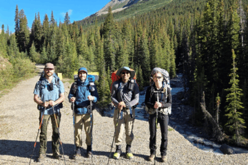
The Gang. Photo Susan Dack
I should add that on day one we saw a sign announcing the trail junction to Cataract Pass leading into White Goat Wilderness, just after we crossed the Brazeau River near Nigel Pass. I realized the potential for a new hiking adventure to Nigel Pass – one that would begin in David Thomson Country.


