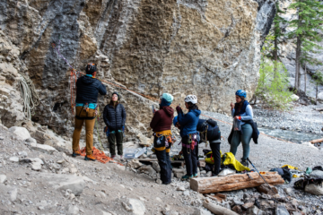
August 3-6, 2019
Spencer and I decided to attempt to tackle a second ascent of the traverse first completed last year by Vern Stice and his partner Jeff. We approached via the highline traverse, with key beta from Vern Dewit, H-Steven Song, and Ben Nearingburg.
On August 2 we approached from Canmore via the Bush FSR to Rice Brook spur road. It was our first time that way and it is truly a drive everyone should do at some point. Extremely beautiful and engaging driving, with a far-out feel. We made it all the way past Vern’s “end of sensible road” in my Ford Fusion, albeit carefully and with some “volunteer road maintenance”, so don’t let anyone tell you you need a Ghostmobile to get back there.

It took us an hour to walk the 4km/400m to get to where Vern and co. parked circa 2014. I have annotated the image he made then, with current obstacles. You would need a stock SUV or better, and to move some rocks (including one large one) to get near where they stopped. Just before that, two large trees are across the road and would need a chainsaw for passage, but they only would cost you an extra few hundred meters of walking so probably don’t bother. Interestingly, there are signs that heavy equipment has been on the road this year, and cleared some obstacles–perhaps they are prepping to resume active logging on an adjacent cut block.

From there we missed but eventually found the trail leaving the cutblock. There is no longer blue flagging present, but we built a cairn on return. Watch for it shortly after entering the cutblock, just after a broken tree overhangs the road. We followed this trail to treeline, then lost it and bushwhacked 2h to the alpine.

The highline approach is beautiful, but requires some work. We followed Vern’s track and did the tedious sidehilling around the shoulder of Osprey Peak. On return we bypassed this with the “red couloir” which is definitely the better option. We arrived at camp after 12h at a pretty leisurely pace.

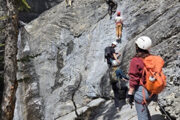
The following morning was game day. We started up using the standard headwall and traverse under Coral Peak, which is simple and well marked due to the camp traffic. The Alexandra W Glacier was in fantastic shape with good coverage and a bomber freeze that kept the rope in the pack. We kicked steps up hard snow all the way to the summit making reasonable time.


From here things got more interesting. Following Vern Stice’s beta, we descended the N ridge in 3 rappels and some downclimbing. We didn’t find his 22m free hanging rappel, descending from the second station (slung choss horn) down a mank mixed gulley to an obvious ledge. From here we were unable to locate their third station and instead slung a large boulder, which allowed us to rappel 35m and transition to downclimbing snow.

Heading down from the summit. Photo credit: Spencer Balay First rappel towards Queens Peak (behind). Photo credit: Spencer Balay Our descent route of Alexandra’s N ridge.


The ridge connecting Alexandra to Queens was covered in firm snow and made for easy travel over what is allegedly loose 4th/low 5th terrain to the summit of Queens Peak (possibly the sixth ascent?). We continued downclimbing on firm snow (beware the large cornices) and completed one optional short rappel, and one non-optional 35m rope stretcher. The long rappel is topped with several loose death blocks that should be treated with significant suspicion by future parties.


The traverse to Mount Fresnoy was simple as advertised, though the snow became unsupportive. We removed crampons and followed rock at its edges instead. A bit of loose 4th class brought us to the summit that has seen many ascents by various ACC camp attendees.

From Mount Fresnoy we made a hasty descent to the Fresnoy-Coral col, then descended the Spring-Rice Glacier (stay right to avoid getting cliffed out by by the headwall). We made quick work of the main headwall and just beat headlamp time back to camp, 18h55m.

Monday we had a very non-alpine start and made a half-hearted attempt at the N ridge of Whirlwind Peak (Rockies West Alexandra Group Route 10). We found greater than expected technical difficulties and conceded ~150 vertical meters from the summit.
Tuesday we broke camp early and hiked out. By taking the red couloir, and bypassing much of the bush lower down by handrailing a scree slope and large slab, we managed to find a better route and reduced our bushwhacking to a dense 300 horizontal meters in the cutblock. I suspect there is a way to connect this to the trail and potentially eliminate the need to bushwhack at all. From there it was a brisk stroll down to the car for victory root beer and chips.


And thus ended the Suffer Mountaineering Camp (SMC), an unguided, self-propelled, non-catered, and fantastically enjoyable endeavor.